![]()
Sat, July 04, 2026


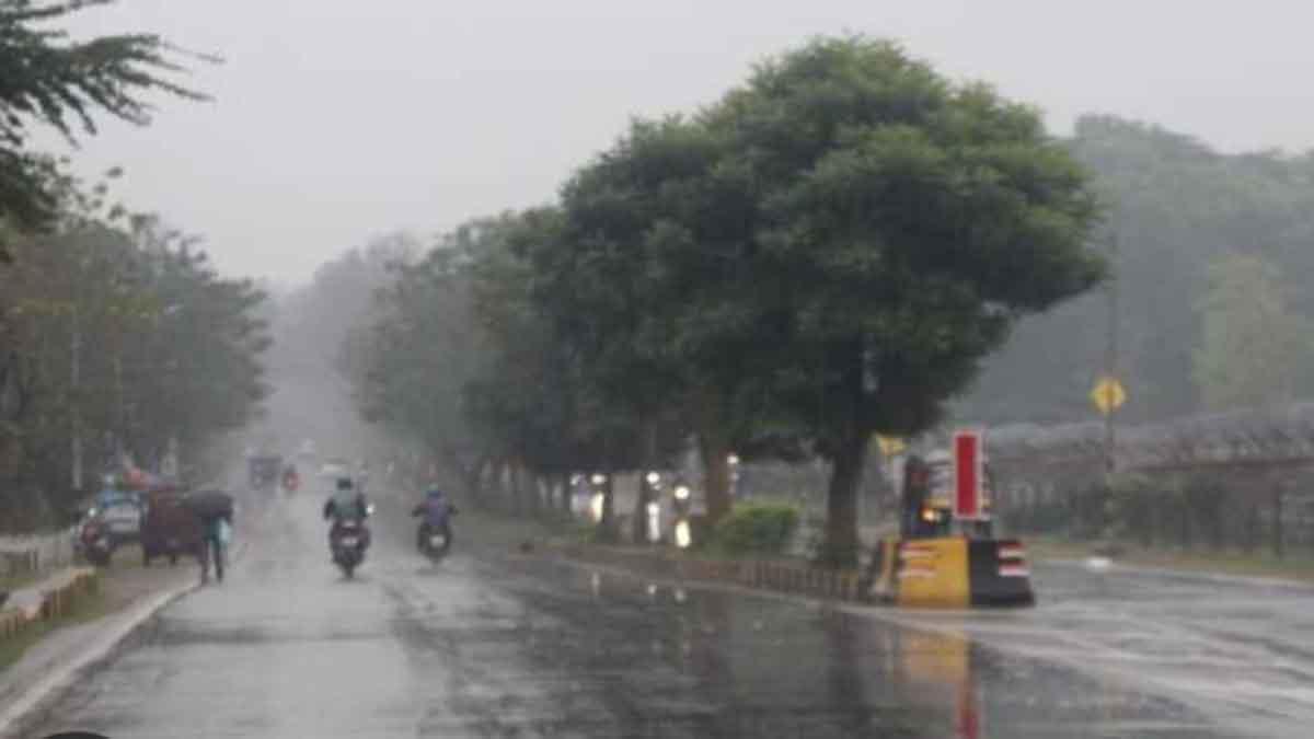
Jamshedpur: The southwest monsoon is poised to intensify across Jharkhand over the coming days, with the India Meteorological Department (IMD) forecasting widespread rain, thunderstorms, lightning and isolated spells of heavy rainfall in several districts till July 8 under the influence of a well-marked low-pressure area over the northwest Bay of Bengal.
The weather system, which remained stationed over the northwest Bay of Bengal adjoining the north Odisha-West Bengal coast on Saturday morning, is expected to move west-northwestwards across north Odisha and Chhattisgarh during the next three days, said a IMD bulletin issued this afternoon.
Meteorologists said the system, supported by a strong cyclonic circulation extending up to 9.4 Km above mean sea level and an active monsoon trough, is likely to keep weather conditions favourable for widespread rainfall across Jharkhand.The IMD has forecast heavy rainfall on July 5 over the south-western districts of West Singhbhum, Gumla, Simdega and Khunti.
The rain belt is expected to shift on July 6 towards Simdega, Gumla, Lohardaga, Latehar, Garhwa and Palamu, before extending on July 7 to include West Singhbhum, Gumla, Simdega, Khunti, Lohardaga and Ranchi.
In addition, thunderstorms accompanied by lightning and gusty winds with speeds of 40 to 50 Kmph are likely at isolated places across the state on July 6 and July 8, prompting authorities to urge residents to remain vigilant.Weather experts said intermittent moderate to heavy showers are also likely over Ranchi, Jamshedpur, Bokaro, Dhanbad and adjoining regions, even though these districts are not under the heavy rainfall warning.
The enhanced monsoon activity is expected to bring down daytime temperatures, improve soil moisture and provide a much-needed boost to paddy transplantation and other kharif farming operations across the state.
However, officials cautioned that short-duration intense rainfall could lead to waterlogging in urban centres, reduced visibility on highways, disruption of traffic, and a sudden rise in the water levels of rivers, streams and reservoirs, particularly in the western and south-western districts.
"The low-pressure area over the Bay of Bengal is maintaining a strong inflow of moisture into eastern India, and its movement towards central India will keep the monsoon active over Jharkhand for the next several days. Isolated heavy rainfall and thunderstorms are expected, especially over the western half of the state," an IMD meteorologist said.
Another weather expert said, "Residents should remain alert during thunderstorms and avoid unnecessary outdoor activities when lightning warnings are in force. Farmers are advised to ensure proper drainage in agricultural fields to minimise damage from heavy downpours."
With the monsoon entering a more active phase, disaster management authorities and district administrations have been asked to keep a close watch on weather developments and remain prepared for any localised flooding, tree falls and rain-related emergencies.
The IMD has advised people to stay updated with official forecasts as the weather system continues to influence rainfall over Jharkhand during the week.


| 14-09-2018 | ||||||
| Sl No. | Parameters | Actual Data(µg/m3) | Standard Limit(µg/m3) |
|---|---|---|---|
| 1 | PM 10 | 64 | 100 |
| 2 | PM 2.5 | 33 | 60 |
| 3 | SO2 | 55.3 | 80 |
| 4 | NO2 | 58.2 | 80 |
| 14-09-2018 | ||||||
| Station | Temperature(degree centigrade) | Rainfall(mm) | Relative humidity(%) | |||
|---|---|---|---|---|---|---|
| Max | Min | Past 24 hrs. | Since 1st March, 2018 | Max | Min | |
| Ranchi | 31.0 | 22.5 | 000.0 | 1010.1 | 95 | 66 |
| Jamshedpur | 34.1 | 26.2 | 000.0 | 1252.8 | 87 | 58 |
| Bokaro | 33.5 | 24.6 | 015.2 | 824.0 | 92 | 79 |
| Daltonganj | 32.6 | 24.9 | 004.2 | 960.9 | 95 | 67 |
© Copyright
Reporter Post.All Rights Reserved |
Powered by: Aptilogic Software |
 |
Page rendered in 0.0735 seconds.
|
Page rendered in 0.0735 seconds.